Taesung Freedom Village, South Korea

Soldiers standing guard at a graduation ceremony for students of the Taesung Freedom Village school.

I came across an article in the New York Times about the installation of ultra fast 5G connections network in Taesung Freedom Village, South Korea and how this would amend some of the inconveniences the villagers face. Upon reading the article, I learned about an extremely unique living situation that I hadn’t really known anything about before and it gave some insights about the experiences of living in a “no-go zone” and a highly militarized border area. Taesung is the only place inhabited by South Koreans in the Demilitarized Zone that separates North and South Korea. After the treaty in 1953, the DMZ was created to keep the warring armies apart. The area was almost entirely cleared out and it became known as one of the scariest places on Earth. However, villagers that live there have become used to their unique way of life and even have a sense of security from the strong military presence.

Because South Korea was determined to keep Taesung populated to serve as a symbol, they give villagers incentives. For example, its residents do not pay national income taxes and are exempt from South Korea’s mandatory military service requirement. There are obviously disadvantages to living in this village too. Taesung has no gym, hospital, supermarket, or restaurant. Furthermore, it is primarily a farming village, and villagers have to request a military escort each time they want to go to the rice patties or get water from the reservoir. It is extremely difficult for visitors to come and when cars enter their GPS navigation goes blank. Furthermore, there is a midnight to sunrise curfew and door to door roll call carried out every night. The 5G network installation was installed to alleviate some of these issues. Now, to get water from the water pump, they can do it through an app from their homes. They can also control their sprinklers for their crops through an app. The community center now has streaming, virtual workout classes and the school has interactive games and sports. To keep the village populated, South Korea spent a lot of money on the school, so it has advanced technology, American soldiers who teach English classes, and now outside students can be bussed in to attend. 

I find all of this extremely interesting for many reasons. First of all, villagers talk about the strange mix of living in what has been known as the scariest place on earth, while also feeling secure because of the heavy presence of soldiers. The villagers “often find themselves front-seat witnesses to the ebb and flow of inter-Korean relations” and until recently, they used to hear North Korean propaganda being blasted from loud speakers on the other side of the border. However, they also state that they have been living there for generations and consider it home. The introduction of the 5G network also creates a potentially interesting situation. Once mostly cut off from the rest of the world, villagers now have access to almost everything they need via internet. I am curious to see what affects this will have the village and its residents. 

https://www.nytimes.com/2009/10/27/world/asia/27iht-village.html?action=click&module=RelatedCoverage&pgtype=Article&region=Footer

https://www.nytimes.com/2017/04/20/world/asia/as-tensions-rise-between-the-koreas-farming-in-the-demilitarized-zone-goes-on.html
Saving Borneo

2015-10-18-1445201362-1473519-huffpostblogphoto.jpg
https://www.huffpost.com/entry/borneo-is-still-burning-a_b_8327360

I remember the flood of notifications on my phone when Notre Dame Cathedral in Paris suffered partial destruction due to a fire. Every news outlet buzzed me when the fire started and continued to notify me with live updates on the development of the fire. Everyone on campus—and worldwide—was talking about the fire, and, before firefighters completely put it out, fundraising efforts began to restore and rebuild the iconic gothic cathedral.

The efforts to rebuild Notre Dame were inspirational and welcomed: it was humanity coming together to save a landmark monument of the West. Within weeks of the fire, the effort to save Notre Dame raised between $835 million and $1 billion USD (Cuddy & Boelpaep). Many breathed a sigh of relief knowing that the cathedral would survive, and would continue to serve as a historic place for Parisians and many others.

The reaction to Notre Dame resulted in many criticizing the donations when, at the same time, we are losing so much of our rainforests to man-made climate change. Months later, disturbing and devastating images surfaced of the fires that struck parts of the Amazon Rainforest in South America. Again, as with Notre Dame, people began donating and tried to help limit the destruction of the fires, which, according to some experts, impacted an area twelve times the size of New York City (Dwyer).

The difference was that we could not just patch a new roof on the Amazon and save the day. While the influx of cash is generous and helps, saving our forests consists of more than just a quick pump of cash when the forest reaches the worst spike in deforestation in over a decade (Dwyer). Saving our rainforests consists of taking action to limit our use and dependency on the products that are destroying our planet.

Sadly, that does not seem to be the direction we are heading in, as CNN has released a story on how the Indonesian Borneo is facing strong deforestation due to our increased demand of palm oil, an oil used in many products ranging from chocolate to shampoo. Indonesia supplies more than half of the world’s palm oil (Wright et. al). In hopes of getting in on the palm oil “gold rush” many farmers create unnatural fires to clear space for more crop growth. The strong demand for palm oil—and the fires as a result thereof—has altered the geography of Borneo, resulting in changing landscapes and destruction of habitat: both of wild animals as well as humans. This loss of habitat has resulted in a further loss of life for the orangutan population in the region, which has already decreased by half in the last forty years (Wright et. al). In three months, the fires have impacted roughly 3,311 square miles of the jungle, releasing more CO2 than the country of Australia did all of last year (Wright et. al).

Unfortunately, the problem is not stopping anytime soon. While companies that are heavily dependent of palm oil for their products have released statements on their intent to push for sustainable ways to create these products, consumer demand for palm oil has only risen in recent years. While this product has in part benefited the people of Indonesia through new wealth and resources to live better materialistic lives, Borneo, considered the “Asian Amazon” and one of the major “lungs” of our planet, continues to shrink in size and burn. The Roundtable for Sustainable Palm Oil (RSPO) hopes to create a better path for sustainable investing in palm oil, but the group fears that its efforts will not be strong enough.

The RSPO notes that, ultimately, it comes down to us, the consumers. It comes down to how much we really need to use palm oil. An estimate funded by the Parliament of the European Union estimates that each of us consume 17 pounds of palm oil per year (Wright et. al). Over the last twenty years, Indonesia’s palm oil exports have gone up 1,500% (Wright et. al). Economics teaches us that producer supply reacts to consumer demand; the companies that are using the palm oil from the rainforest are going to place money over all. While the European Union has started to phase out palm oil and encouraged its citizens to use the product less and less, these regulations are not applicable to the other countries. The RSPO and the EU believe that if we phase out palm oil, we may still be able to save Borneo.

A resident of the area, through tear-filled eyes, said that he hopes to one day be able to bring his daughter to the forest and show her the beauty of the area. His big ask of consumers: “please, no more. Just stop it.” The report on Borneo appeared at the bottom of CNN’s page. I did not receive a notification on it, nor is everyone talking about saving Borneo. We take these places, which serve as the lungs of our planet, for granted. We believe that we can manipulate them and do as we please. At what point will we realize the costs of destroying these places? Notre Dame is an iconic place, and it is a great thing that we saved it. However, Notre Dame is not essential for the continuation of our planet; the future of Earth does not depend on a cathedral. The future of our species—and many others—on Earth depends on having rainforests and other sources of oxygen. We must step up and save these places that, on top of being our planet’s lungs, house many humans and other species. And, the best part is, it is easier than many think. We don’t have to donate billions of dollars. Individually, to make a difference, all we have to do is take steps to reduce our contribution to the destruction of the planet. So, next time you reach for that enormous bottle of shampoo because of the sale price, think about what that will do to the environment.

Bibliography:

https://edition.cnn.com/interactive/2019/11/asia/borneo-climate-bomb-intl-hnk/index.html

https://www.bbc.com/news/world-europe-48039770

https://www.npr.org/2019/11/18/780408594/amazon-rainforest-sees-biggest-spike-in-deforestation-in-over-a-decade

https://www.cnbc.com/2019/08/27/amazon-wildfires-how-to-help.html

https://www.dailymail.co.uk/news/article-7647067/Viewers-react-David-Attenborough-documentary-Borneo-rainforest-destruction.html

Maps Made ‘From the Mind,’ Not From GPS

When visiting a new city, it is common for people on foot and travelling by car to navigate the city by way of a GPS system. As convenient as this service is, city goers have become increasingly dependent on their phones to understand their spatial surroundings. Designer, Archie Archambault, challenges our perceptions of a city’s landscape, using the minds of locals to reshape maps of the city to match how we conceptualize these spaces.

Archambault developed his series “Map of the Mind” by interviewing locals from various major cities across the world to build maps of their cities based on the emphasis they place on each landmark of a city’s geography. The methodology of Archambault’s work is to depict the highlights of any city. Each highlight is indicated with a circle. The size of each circle, whether it is a neighborhood, park, or other monument indicates its importance in the city. The basic idea for this project came as a result of a peer living in Washington D.C. free hand drawing a map of their city. From here, Archambault expanded his tour across the world, staying with locals in various cities, working with historical organizations, and local cartographers.

Archambault’s project emphasizes the society’s significant dependence on GPS devices to understand our spatial existence. Though these maps do not necessarily help viewers get from Point A to Point B, his work furthers the suggestion that those who rely more on spatial recognition using landmarks exercise parts of their brain that are often ignored by those dependent on GPS to situate themselves. A study conducted by McGill University in 2010 found that those more reliant on GPS were not exercising the function of their hippocampus as much as those who navigated cities without their phones(Poon 2015). Archambault suggests that “This part of our brain is so incredibly strong, and we really aren’t using it all” (2015). Our brains are capable of adapting and recognizing landmarks more than our phones give us credit for.

Archambault’s maps emphasize how our spatial understanding has continuously been limited by the use of technology. Our understanding of the spaces we inhabit should not be limited to secondary data layering from an aerial view. As convenient as GPS is, we are not exercising key functions of the brain that permit us to situate ourselves and navigate new spaces. 

I’ve attached a map that Archambault published as an extension of this project.

Archambault, A. (2018). New york state map print

Poon, L. (2015). Maps from the mind, not from the GPS. City Lab, Retrieved from https://www.citylab.com/design/2015/11/maps-made-from-the-mind-not-from-gps/415128/?fbclid=IwAR2wQ1a0SWSwjJQ7Pw0LugePuFCiuIgR7pcwewG_FS40eSMRd5dXc8xgjsk

The Proposed Downtown Utica Hospital

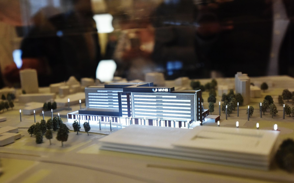
A miniature model of the MVHS hospital downtown with the accompanying walkways, lighting, and parking garage at an unveiling on in May, 2019.

As we’ve discussed in class on a few different occasions, the local healthcare system Mohawk Valley Health Systems is moving forward with a plan to build a hospital in downtown Utica. Before getting into the specifics of place I think it’s important to acknowledge the need for a new hospital in Utica. As someone who is involved in the local emergency care system and has spent time in both Saint Elizabeth’s Medical Center and Faxton Saint Luke’s Healthcare, it is clear that the current hospital system is outdated. The two hospitals have split up many of their services to provide coverage for patients, but this leaves patients wondering which hospital they should go to depending on the medical emergency. This is a critical fault within Utica’s emergency care system as in delayed time in emergency situations thinking about hospital locations can be costly. Additionally, both of the hospitals are in dire need of renovations. Saint Luke’s has attachments upon attachments that make navigating the building nearly impossible. Saint Elizabeth’s was built over 150 years ago. Therefore, although both hospitals can provide the essential medical services, a new combined location that localizes patient care, has modern facilities, and is accessible to patients is necessary.

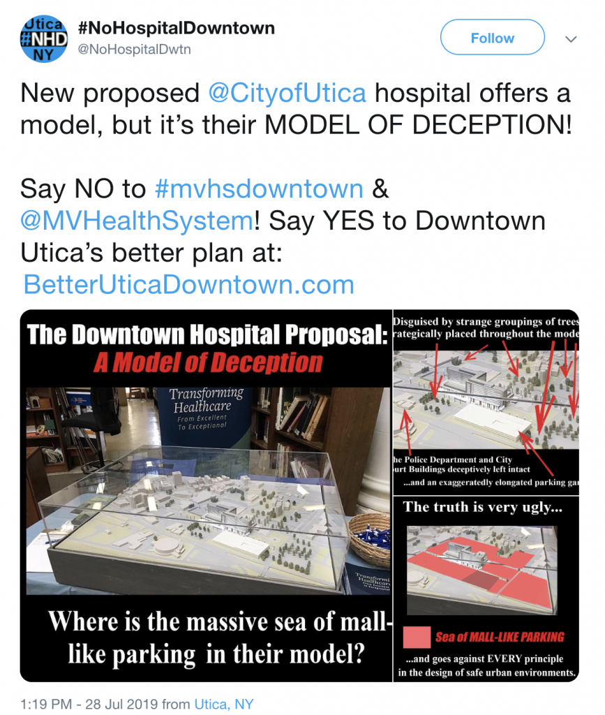
As in most debates there are two sides to the downtown hospital: the group #nohospitaldowntown and MVHS. The #nohospitaldowntown group recognizes the need for a new hospital in Utica, but advocates that the location should not be in downtown Utica. They describe the historic buildings in the area, various businesses, local homeowners, as well as the corruption of MVHS as reasons to not build in downtown Utica. The usage of eminent domain to remove many of remaining owners of properties in the hospital’s footprint has sparked a legal battle between the two groups.

While #nohospitaldowntown originally protested the hospital because of the destruction of the historic Columbia Lafayette Neighborhood and the affected buildings, the group now takes on a stance of corruption and anti-establishment. A quick look at their website and twitter feed shows their clear opposition to those involved in MVHS, local politicians, and state officials. They highlight an email scandal, the push through of a state mandated environmental process, and the lack of public input as rationale to reevaluate the process to build a hospital in downtown.

In contrast, MVHS is advocating for all that will come with a new hospital downtown and ignoring the claims of the #nohospitaldowntown group. They make no mention of the affected historical buildings and the various people and businesses affected by the building. What they highlight are the improvements that a new 373-bed hospital building will bring. They focus on the importance of centralizing the hospital system, new departments within the hospital, accessible campus as reasons to build the hospital. MVHS advocates that the community will be able to walk through the hospital campus and use the parking garage as parking for local events like the Utica Comets games. Additionally, they highlight the potential for reinvigorating local businesses in downtown because of the influx of people that visit patients and the professionals working in the hospital.

There is a clear dispute of the purpose and usages of place in the downtown hospital debate. The preservation of place is at the center of this debate, whether the old and historic of Utica should prevail or the new and modern. Similar to the recent reading by Sharon Zukin regarding the authenticity of place, the new hospital would be a large change in the character of the area and rid the area of its “origins”. Yet the hospital would also provide necessary improvements in the local healthcare system. While both sides offer valid arguments, it appears that the legal and financial capabilities of MVHS and the state will push through the development of a hospital in downtown Utica.

Sources:

http://www.nohospitaldowntown.com/

https://mvhealthsystem.org/downtown-hospital

https://www.uticaod.com/news/20190529/health-system-unveils-model-with-downtown-utica-hospital

https://www.wrvo.org/post/downtown-utica-hospital-project-faces-lawsuit

The Heidelberg Project: Art as a Strategy for Community Revitalization


Tyree Guyton’s childhood home on Heidelberg Street, where his mother still lives among the sculptures (www.heidelberg.org).

Tyree Guyton grew up on Heidelberg Street on the East Side of Detroit in the 1950s. When he returned in 1986, he found his once thriving neighborhood deep in poverty and riddled with drugs. Disappointed with the loss of what once was, his solution was to turn the neighborhood into an art environment now extending along multiple blocks of the street. The goal was to revive and enrich the lives and social and economic health of the community through art, namely The Heidelberg Project.

The art, primarily sculptures, is made up of found objects and integrated into the landscape of vacant houses, and anyone who didn’t know better might think the street is a junkyard. While it was originally met with backlash from neighbors who didn’t want the eyesore in their backyards, Tyree’s artwork has brought attention to urban blight and improved the social and economic conditions of the neighborhood and surrounding communities.

The art is participatory and encourages community involvement, but that is not enough. While the art itself can only do so much to improve the wellbeing of a community, Tyree has turned The Heidelberg Project into a philosophy of social change. His philosophy is to be part of the solution. The solution to whatever problem you may encounter, but for him that problem is urban blight in his own backyard. The Heidelberg Project has partnered with schools surrounding the neighborhood to provide a free arts education in and after school to empower students to become change makers in their own communities. What started as a way to bring back a neighborhood of the past has turned into a movement for change in the future.

I am not suggesting that we turn every poverty stricken street corner or abandoned building into an art installation, but how can Tyree’s philosophy of social change and revitalization be applied to other struggling communities? While The Heidelberg Project is successful in the East Side of Detroit, I would be curious to see how well a similar project would be received elsewhere.

Sources:

https://www.heidelberg.org/

https://www.tyreeguyton.com/

Place-based Education vs. Globalization

Image result for place based education

In our increasingly globalized world, it is common to feel that sense of place is being eroded. At the same time, however, people are reacting to maintain the importance of place. One field where this reaction is taking place is education.

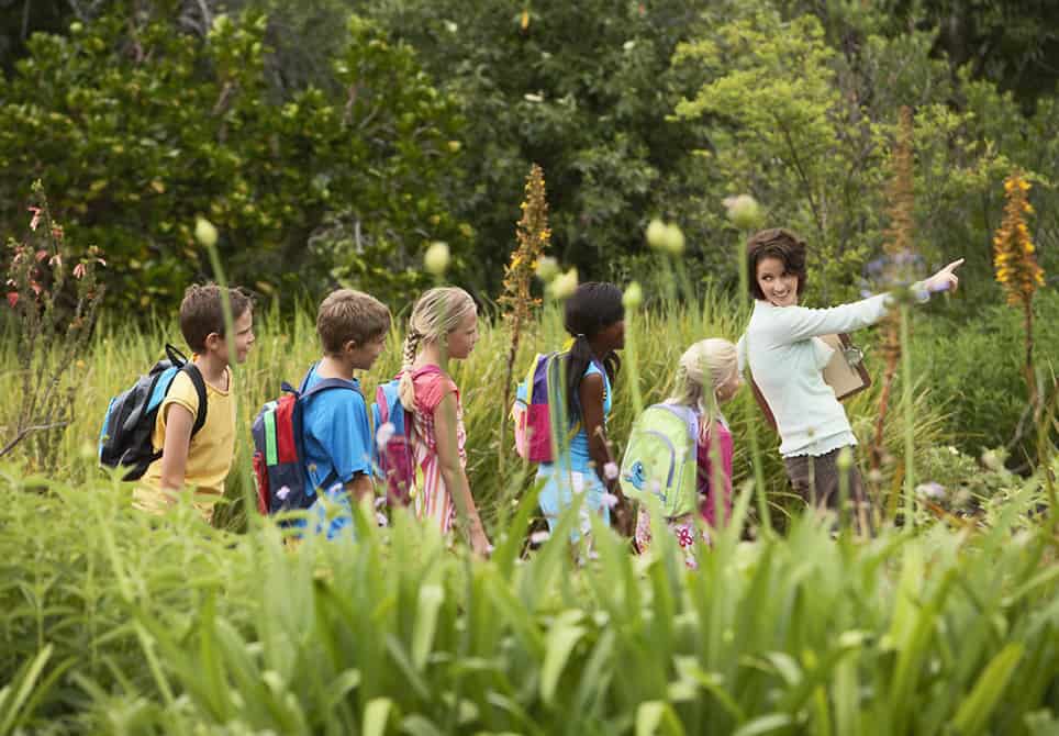
Place-based education was developed in the early 1990s as a reaction to globalization and homogeneity. Place-based education is centered in the immersion of students in local heritage, cultures, landscapes, opportunities and experiences, using these as a foundation for the study of language arts, mathematics, social studies, science and other subjects across the curriculum.

There are three main goals to place-based education:

  1. Boost student achievement,
  2. Enhance community social and economic vitality, and
  3. Maintain ecological integrity.

Place-based education is often thought about in conjunction with environmental education, where the “place” at hand is the outdoors. But this newer educational theory is more than that: it is learning through experiences, and has proven to be successful in different settings from rural to urban. The theory maintains that focusing on the hyper-local has many benefits, including a better understanding of large-scale, global issues.

It is true that globalization is changing how we think about place, and this creates a valid fear about the diminishing importance of local communities. It seems that place-based education could work as an antidote to the negative effects of globalization, and for this reason, I’d say it’s worth a shot.

Sources:

https://promiseofplace.org/what-is-pbe/what-is-place-based-education

https://www.gettingsmart.com/2017/02/what-is-place-based-education/

https://en.wikipedia.org/wiki/Place-based_education

Changing Identities of Public Spaces After the Fall of Socialism

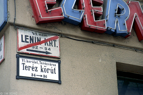
A street sign for Theresa Circle replaces one for Lenin Circle (Budapest).

Many countries of the former Soviet bloc struggle to form their new identities since the fall of the Soviet Union, especially when it comes to deciding what to keep and what to lose from socialist economies and societies. Welfare systems and government media are only two examples of main battlefields of this identity crisis, but a far more symbolic, yet also semantic aspect is the renaming of public spaces.

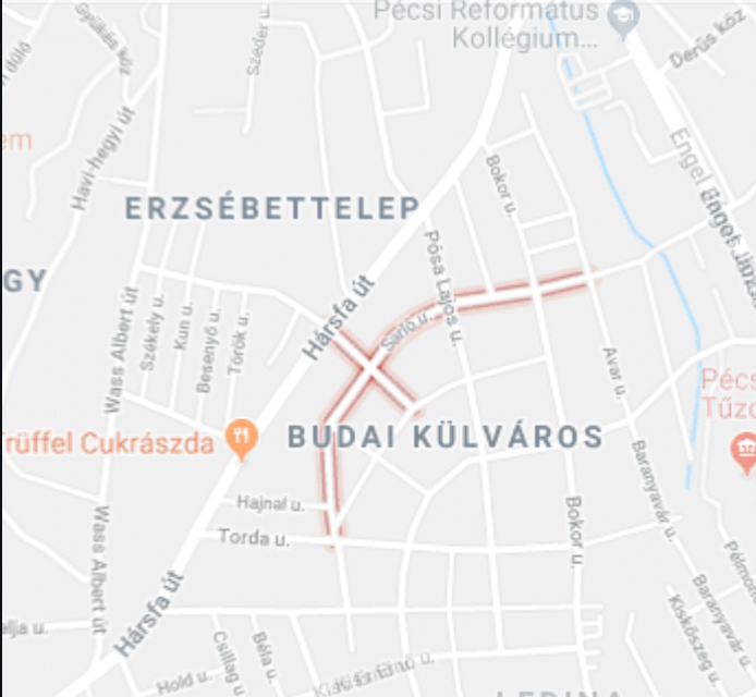
In 1945, as the Red Army not only entered Hungary and ended German occupation but decided to stay. As the country was sucked into the orbit of the Soviet Union, major arterials, important streets, and central squares traded their signs one by one. In some examples, these efforts were to erase the legacy of certain historical figures, usually revolutionists. More prominently however, they created representation for socialist ideology. Budapest’s Lehel Sq, named after a medieval rebel, became The Square of the Outstanding Worker. They even changed plainly named spaces, like Moon St, after the infamous Rosenberg couple for example. Streets named for Lenin, Marx, and Engels appeared all across the country. In the southern city of Pécs, Hammer St and Sickle St crossed each other.

Sickle St and Hammer St as seen on Google Maps.

Efforts to reclaim these spaces started in the 1990s, as the Soviet Union fell and Hungary transitioned into a more democratic life. Statues and plaques commemorating most communist and socialist achievement disappeared. People again walk on Moon St and they visit Lehel Sq.

In Pécs, Marx St stuck around for almost 30 years and by that time, no one explicitly minded its presence. Even though they changed it to Albert Wass St—to commemorate an exiled victim of Marx’s ideology—, people continue to call it by its old name. Sickle St now crosses Peony St.

Do these names actually convey historical eras and their politics? Will their messages change if their names do? Should it matter that these names change? Residents of these spaces often have no attachment to the figure their street is named for, or cannot comprehend the actual significance of Stalin (or Lenin, etc.) on past society. On the other hand, how do we preserve the memory of those hurt by the past, such as Wass, and provide space for their representation? Do we need to return to previously used names, if possible? Should generations growing up on Hammer St now call Peony St their home? Similar questions surround municipal policy regarding these public space identities, and often people engaged with the local identity struggle to answer. Many local residents pointed out that their cities have enough to deal with, and these days, Lenin should be the least of it.

Sources

Schools Not a Safe Space for Kids this Back to School Season

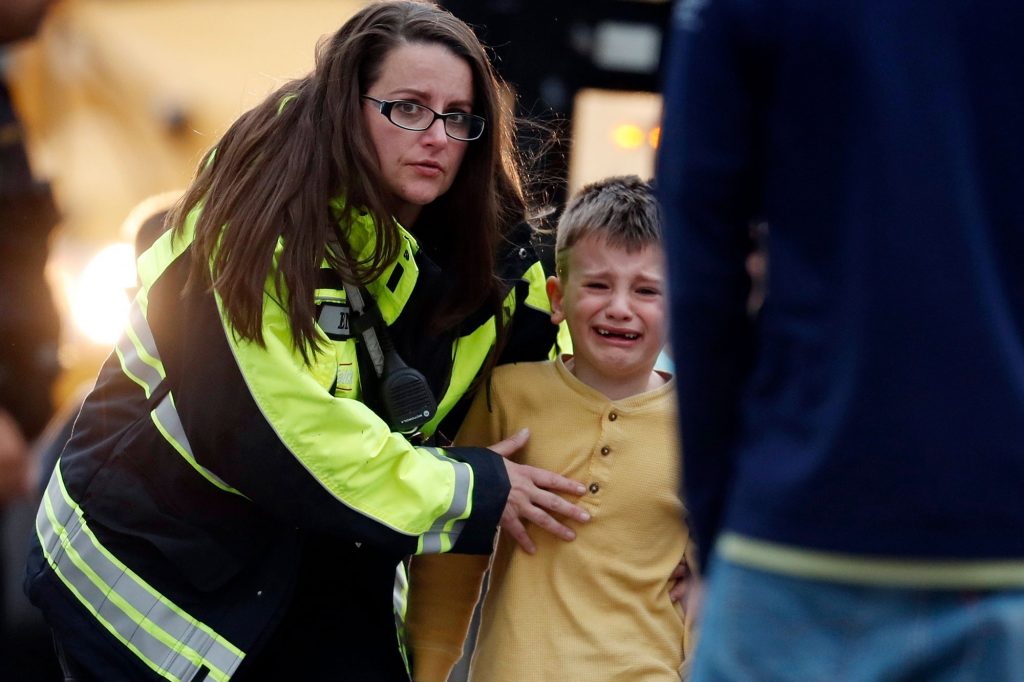
RETRANSMIT WITH ALTERNATE CROP Officials guide students off a bus and into a recreation center where they were reunited with their parents after a shooting at a suburban Denver middle school Tuesday, May 7, 2019, in Highlands Ranch, Colo. (AP Photo/David Zalubowski

The release of the Sandy Hook Promise back to school ad has acted as a chilling reminder of the reality of back to school and what it means for teachers, parents and kids alike.

Schools are no longer what they used to be. Children used to get anxiety about making friends at school. Now they walk into school with the fear of school shootings and when their school will be hit. Parents used to worry about their kids having a good day at school and having a smile on their face at the end of the day. Now, these parents have to wonder if they will even see their kids at the end of the day.

The role schools used to play in the lives of kids has drastically changed. From a place of learning, friendships, self-discovery and what many would call a safe space for kids to grow schools have become a place of fear. Kids have lost their sense of school as a safe place. 6.7% of students skip school out of fear of school shootings. An almost 3 percent increase over the last 20 years. Even more drastic, 57% of teens believe a school shooting can happen at their school.

No longer are fire drills the only drills kids have become accustomed to. The days of getting excited to get out of class for a fire drill are no longer. Schools now run school shooter drills that kids have become accustomed to. Almost too accustomed to. For many student’s it is becoming increasingly difficult to know whether a drill is not a drill this time. It has become to reality for students to expect anything to happen at their own school, as a Texas teen said, “It’s been happening everywhere I always kind of felt like eventually it was going to happen here, too.”

It is clear that schools no longer possess the role in kids lives that they used to. The feeling of being able to go to school and feel safe from the outside world, to feel protected inside the walls of schools and the chance to just be a kid and to grow are gone.

The implications of this are range far and wide. In thinking about safe spaces for kids, home and school would be the first few answers someone may give. Friends houses can still be vulnerable, going out into town doesn’t always offer safey and comfort. Home isn’t a safe place for every kid. So this means that some kids are left with no safe places. And for those that do have a safe place at home, they are left with one true safe place. The effects of this can be psychologically damaging, it can hinder growth, and tamper learning inside and outside of the classroom.

The transformation of schools from a place of learning and opportunity to a place of fear is a transformation that cannot be ignored and must be reversed for the hope of generations to come.

Sources: https://www.edweek.org/ew/articles/2018/02/28/lost-sense-of-school-as-a-safe.html

6.7% of Students Skip School out of Fear. Worry Over School Shootings Is Up. Yet School Violence Is Down. What Does This Mean?

https://www.nbcnews.com/better/health/school-shootings-how-parents-can-cope-their-own-fears-anxieties-ncna908276

https://www.scarymommy.com/school-shootings-homeschool/

https://www.pewresearch.org/fact-tank/2018/04/18/a-majority-of-u-s-teens-fear-a-shooting-could-happen-at-their-school-and-most-parents-share-their-concern/

Climate Change as it Relates to the Reshaping of Place

https://climate.nasa.gov/effects/

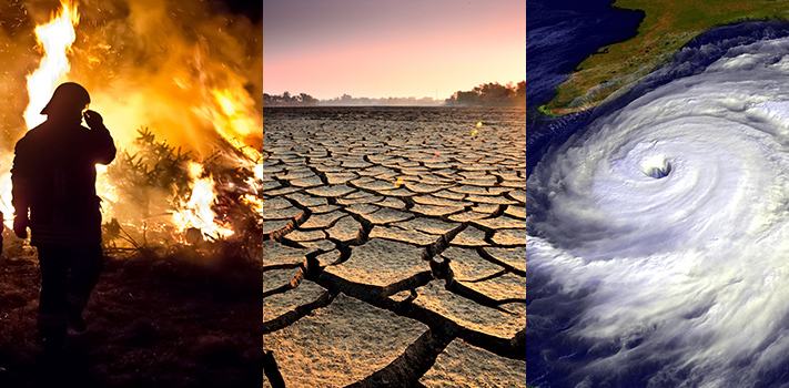
The urgency underlying last Friday’s global climate strike was clear; we’re running out of time to save our planet. And while it’s true that there is still time to change course, global warming is already reshaping all sorts of places around the globe. Several examples illustrate the breadth of these changes, though the list is not exhaustive. 

  1. Although natural disasters are inevitable, global warming makes them worse and more frequent. Rising temperatures increase the intensity and frequency of storms and floods, threatening to make the damage that Dorian caused routine. Global warming also prolongs and intensifies forest fires, irreparably damaging ecosystems from the Amazon to Yosemite. 
  2. Global warming is also hurting animals directly. The Great Barrier Reef and other marine ecosystems around the world are suffering because of rising temperatures, animals are changing their breeding and migration schedules, and arctic animals are experiencing shorter hibernations and longer, physically exhausting swims as the ice sheets melt. 
  3. And it’s not just animals and ecosystems, though they’re vitally important. Global warming is also threatening agricultural crop yields, polluting air, and threatening infrastructure (train tracks in Europe recently buckled during the record-setting heat wave). 

And that’s just the tip of the iceberg. In the not-to-distant future, island nations will sink, coastal cities will flood and become unlivable, and the subsequent wave of climate refugees will strain our already strained food supply, leading to resources shortages and potentially war.

The science is clear; global warming is reshaping place as we know it. Without meaningful action, the places that we, and animals, call home will no longer exist. The places and infrastructure that we rely on to keep society functioning will no longer exist. And the places that are crucial to the functioning of our planet, like the Amazon, will no longer function as needed. 

The result? Not just a conceptual reshaping of place, but the total elimination of many places. Eventually, unless we start making real change soon, the place we all call home, Planet Earth, will meet the same fate. 

Sources: 

https://www.ucsusa.org/global-warming/science-and-impacts/impacts/global-warming-and-wildfire.html

https://www.cnn.com/2018/04/18/world/great-barrier-reef-coral-dying-climate-change/index.html

https://www.livescience.com/23026-global-warming-changing-world.html

https://www.edf.org/climate/how-climate-change-plunders-planet

Diminishing Spaces: The Impact of Technological Advancement on Physical Locales

While the acceptance of LGBTQ+ individuals in the U.S. is at an all-time high, homophobia and transphobia are still pervasive and prevalent issues that plague society. 

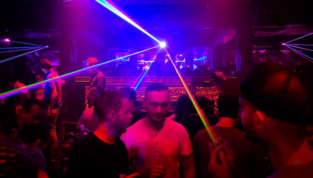
For many people in the queer community, gay bars provided an escape from the dangers of everyday life. For a short time, LGTBQ+ folk no longer felt minoritized, marginalized, or judged, and could exist in a safe and accepting environment. 

In recent years technological advancements compromised this once sacred space. Due to the use of Grindr, Hornet, Scruff, and a host of other queer dating and cruising apps, the physical scene for gay and queer bars dissipated. According to Damron, there were more than 2,500 gay bars in 1976 in the U.S., but now, there are fewer than 1,400 in the entire world (Morgan).

While there are other factors that have played into this, apps transitioned a once physical scene into an online platform. In the online world, one can find instant gratification far quicker than in the physical realm (Norman). Furthermore, one does not need to clean up and drive to find others, but can simply open one’s phone and access thousands of people. For those in the queer community in smaller, more conservative towns that never had LGBTQ+ friendly nightlife, these apps created a platform that previously did not exist.

This transition from a physical locale to the interweb begs a few questions. Does the presence of an online community adequately replace that of a physical space? Can we consider dating and cruising apps to be a space, despite the lack of an actual location? Regardless of the answer, the steady corrosion of gay and queer bars and nightclubs transformed how members of the LGBTQ+ community interact with each other, and this will only intensify as technology and the use of these applications advance and continue to gain popularity.

Bibliography:

https://www.bloomberg.com/news/articles/2019-06-28/the-american-gay-bar-is-down-but-don-t-count-it-out-just-yet

https://www.theguardian.com/commentisfree/2015/jul/15/goodbye-to-all-the-gay-bars-are-dating-apps-killing-queer-culture

css.php